Showing posts with label Weekend Trips. Show all posts

6.20.2023

Looking Back: Juneteenth Weekend

In the spirit of some of my blogger friends, I will call this Five Things Tuesday, the road trip version! Since I had an extra day off, I drove down to Sequoia National Park for a little bit of backpacking. Here are five things from the long weekend that were interesting or fun! 

Backpacking in Sequoia NP: I had a great time hiking around Sequoia National Park, although once again, I was foiled by snow, downed trees and high river (read: impassable) crossings. However, I never let that bother me too much and I had a fun time exploring, even if I could not do the loop that I had intended. This year has been difficult for hiking plans, as the normal entry to Yosemite is closed due to road damage, the road to Kings Canyon is closed due to road damage and many of the roads in Sequoia are still closed due to snow and/or road damage! It was a rough winter in the Sierra, let me tell you. 

View of Valhalla and Hamilton Falls

Hamilton Lake

Trip to Aldi: Since I was driving down through Fresno, I decided to stop at Aldi (this is the closest one to my house, and is about 200 miles away from me) for a little wander through the aisles. Since I was going to be in the car for a while and I couldn't have food in my car at the park, I did not buy much, but I had a lot of fun checking things out. The weird thing though is that when I arrived, there were only about 6 cars in the parking lot and I feared they were closed but they were open but it was nearly empty! Maybe the Fresnans have not gotten the memo that you can get good things at Aldi on the cheap? It probably did not help that the following stores were all on the same street within about a two mile stretch: Smart and Final, Grocery Outlet, Costco, Albertsons, WinCo. 

Tesla Semi Truck: I saw this on highway 99! I did not know that Tesla made a semi and it was a very strange site; it looks like a toy. I checked later and apparently the Modesto Frito Lay factory is testing them out so that is why I happened upon one. 


Road Trip Snacks: Although I normally try to eat healthy, when I go on a road trip, I give myself a pass to eat what I want! This included corn nuts (guilty pleasure), peanuts (the dry roasted ones with the yummy MSG) and lots of jerky! Actually I also bought some cheese and carrot sticks from Aldi on my way home, so I guess this time the snacks were not really that indulgent! 

Pilot: My Favorite Gas Station: Every time I go on a long road trip on a major highway, my stop of choice is Pilot/Flying J. When I go to Oregon in the summer, they are perfectly spaced out and my routine consists of the same thing every time - get gas (even if I am half full), get ice tea/lemonade combo (Arnold Palmer) refill with lots of ice and use the bathroom. Every. Single. Time. I have had disappointment when stopping at other truck stops and they do not have unsweetened iced team from the fountain drink section (not a bottled one from the cooler) so I just stick to the one that has what I want! 

What did you do this weekend? What are your favorite road trip snacks and/or break stops? 

6.05.2023

Looking Back

As I mentioned last week, Memorial Day weekend normally kicks off "summer" in these parts. It means we can start swimming a little, even if the water is frigid and it marks the beginning of camping and hiking season. This year we had a very high snowpack and some parts of the Sierra have over 10 feet of snow still, but this did not stop me from getting outside anyway. Here are some of the highlights. 

Memorial Day weekend, I went to Yosemite for a few days of backpacking. Basically depending on what way the hill was facing and whether or not there was tree cover, there was snow from about 6,000 feet in some places or as high as 8,000 in others. Additionally there were a lot of downed trees due to either the recent fires and or the snowpack causing them to fall. The cherry on top was the creeks and rivers, which are all swelled up three or four or more times their normal size. This meant altering my route several times, but did not detract from the beauty of the region. 

Panoramic Trail view of Half Dome

Top of Nevada Falls

Sunrise on Half Dome

Merced River

Snowy Trail

Four Mile trail - view of Half Dome

Four Mile Trail - view of Yosemite Falls

Four Mile Trail - view of El Capitan

Last weekend was my Dad's birthday and I met up with my family to do some regular camping, hiking and a couple of rounds of Spades. We met near Mt. Shasta, in an area called Castle Crags. I have driven by this a bunch of times and have even hiked near it, but I did not know that you can hike right into the middle of it and it is really beautiful! It was quite hot though, probably over 90 degrees and we wanted to go swimming, but the Sacramento (and all of the rivers) river is still flowing a bit too fast for our liking. 

Mom and Dad looking at the Crags

Crag Dome and Mt. Shasta

Dad nearly at the top of the Crag Dome trail

View from the top (with Mt. Shasta)

What did you do this weekend? Is it hot where you are? Have you gone swimming yet this season? 

4.24.2023

North Bay Overnighter: My First Bikepacking Trip

You have already met Bob, and you know that I have not really had a lot of experience with mountain biking, but that did not keep me from deciding to try bikepacking out as soon as the bomb cyclone had passed and we had a sunny weekend. I figured why not, since I already have a lot of backpacking and camping gear, so all that I needed was something to put the gear in and attach it to my bike and I would be good to go. I figured I could learn the rest as I went.

Bolinas Ridge Trail


What is bikepacking? It is basically the same as backpacking except instead of carrying all of your stuff on your back, you carry it on your bike. Your stuff includes a tent (unless you are going to cowboy camp, aka lay out your bedroll under the stars) and sleeping gear at the very least and can include a stove, pots, food, bike tools, extra clothes, electronics and toiletries. So, like I said, pretty much like backpacking. Usually the route consists of more trails than pavement, also like backpacking, but can be on highways, gravel roads, bike paths, logging roads, forest service roads or fire roads. 

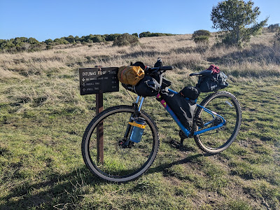
Here is Bob, all loaded up and ready for adventure!


How did I find out about this? I have no friends who do this. To be honest, and I am a little embarrassed to admit this, I found it on YouTube. I was looking for ideas for summer hiking/backpacking and I stumbled across this channel where two regular people completed part of the Great Divide Mountain Bike Route (GDMBR) and I thought, "I want to do that!" and I started looking into it. I found a great local route that I could get to without driving and off I went. Of course, before this, I went pretty deep into a YouTube wormhole. You know how that goes. 

The route that I found can be found on Bikepacking.com and is called the North Bay Overnighter. It is an 80 mile route that goes from the Golden Gate Bridge (GGB) through the Marin headlands to Samuel P. Taylor park near Point Reyes and back a different way to the GGB to finish the loop the second day. These are mostly trails that I have run on before, so I felt pretty comfortable with the route-finding aspect of the trip although this also meant that I knew exactly what I was up against in some cases, which was a little bit daunting! 

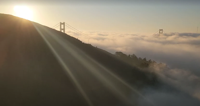
Day 1: The official route starts and ends at the Anderson parking lot on the Marin side of the GGB. However, since I live in Oakland, I decided to get there by bike rather than driving. I started off by riding my bike from my house to the BART, which I took to the Civic Center station in the city. It was pretty early in the morning and the only people on the street besides me were the homeless, the druggies and the prostitutes. This is not the most beautiful part of the city, let me just say that. From the Civic Center, I rode down to Fort Mason and then went past Chrissy Field to the end of the GGB. I crossed the bridge in the fog and wet and finally got to the official start around 8:00 am with about 9 miles under my belt already. 

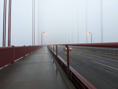
Crossing the Golden Gate Bridge

View of the Golden Gate Bridge from the headlands


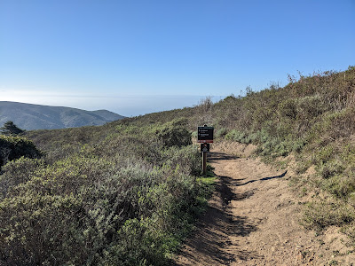
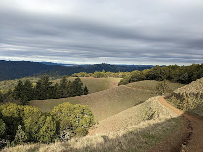
From there, the route goes up the road to the Coastal trail, and the sun was just starting to break up the fog and I had some really nice views of the bay. I then cruised down the Coastal trail, which is a very gradual downhill, although there were a few rutted areas that made me realize that I had no idea if was best to ride in the rut or try to stay on one of the side lumps, and at one point I heard another bike behind me and I was not sure if I should pull over or get off to the side or...what the rules were! The route goes down, crosses the road and then heads back up Bobcat, which is really just one big mile and a half long uphill and is a trail I have run many times, but have never been able to run the entire uphill without walking a little. However, I rode the bike without stopping the entire time and I was so proud of myself that I stopped at the top for a snack before heading down towards Tennessee Valley. 

From Tennessee Valley parking lot, the trail goes back up the Miwok trail, which was my first experience with the hike-a-bike! Also by now it was actually getting warmer and I shed yet another layer on my way up this hill. After the uphill, Miwok is a nice gradual downhill that crosses highway 1 before going back up towards Dias ridge. Dias was my first true single-track and I had "fun" learning how to manage the hairpin downhill turns, although I did  have one slow speed fall in this section. Side note: the completely packed bike is probably about 50 pounds, which is hard to control on the curves! You live and you learn, I guess. 

Dias Ridge Trail


After going down Dias you get to Muir Beach and this is where I had to break out the GPS. The trail was hard to find, as the route takes you basically up the side of a hill in what looks like someone's backyard, but I think it is just an attempt to not make you ride on the road for that section. However, it is a little strange, as you come out at the top on the road, which you then have to ride on for about a mile and a half before you go back onto the trail again. I was a little afraid of the road as I have driven on it and seen cyclists and it seems a bit scary (it is a windy coastal road) but people were polite and the traffic was still not yet too bad. 

Getting off the road and back on the trail toward Cardiac/Pantoll


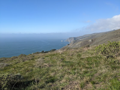
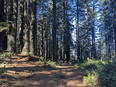
The trail takes you to Cardiac and you cross the Dipsea before heading to Pantoll, which is a parking lot, bathroom, water fountain and camping area. Apparently there is hike in/bike in camping here but I was only about 21 miles into the official 40 that I was supposed to do this day, so I kept going. From Pantoll, you ride on the road uphill for about 2 miles; again, this was with cars, but there were also a lot of bikes and the cars were pretty polite. Then came one of my favorite parts of the ride: Ridgecrest Blvd. This road was mostly downhill and is very flowy, with barely any cars AND a view of the ocean for days, and then you go into a redwood forest and it's dark and moist and magical. It is super cool! It was so SO fun. 

Ridgecrest Drive

After four miles, you turn off on the Bolinas Ridge trail, which is dirt but doesn't have too many steep ups or downs and goes on for several miles. However, the very end, when you are headed down toward the turnoff to the camping, is a lot of bumpy downhill, which was quite jarring at times. When you get almost to Point Reyes, you turn off and go to Samuel P. Taylor park, where there is a hike in/bike in campground and for $7 you can put up your tent! I got there around 5 pm, put up my tent, made dinner and then spent a wonderful few hours listening to my audiobook before heading to bed. I did this trip in January and I was the only person in the shared campsite! 

Bolinas Ridge Trail

Samuel P. Taylor hiker/biker camping

Day 2: The next morning I got up early, realized I was out of fuel, drank a cup of cold coffee, strapped on my headlamp and hit the road. Well actually it was a nice flattish paved trail at first, but very soon afterward, I went straight uphill into the fire roads again. Seriously, my first 2 miles were flat, then the next 8 miles were about 3,000+ feet of climbing. Again, I embraced the suck of the hike-a-bike, but I spent a long time wondering when the joy of the downhill was going to come. When the downhill finally came thought, at first it was not very joyful. It was very rocky and rutted and I actually had to push my bike on some of the downhills! 

View from the top of the hike-a-bike near Kent Reservoir


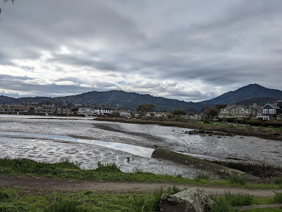
When I got back to the Bolinas Fairfax road, I decided that instead of going into Fairfax and then back up the hill to Tam and then down again to Tennessee valley and then up again to the start line where I would then have to cross the bridge and ride the BART, I would rather skip the extra hills and the public transportation and head back home via the Richmond bridge. So I went through Natalie Coffin park into Ross and from there I took a series of bike paths into Larkspur, where I rode out onto the Richmond Bridge. Once I got to Point Richmond, there was only about a mile of street riding before I got onto the bike path along the bay. A lot of this part of the route was on the San Francisco Bay Trail, which is a trail that goes all the way around the Bay Area. Some of it is on an actual dirt trail and parts of it are on roads and bike paths, but all together I believe there are over 500 miles! 

Larkspur bike path

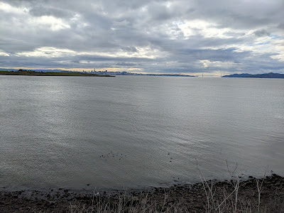
View of the city from Richmond (SF Bay Trail)

Once I got to Emeryville, I had to go back onto the streets to get to Oakland, but I have to say most of them have pretty good bike paths, so it was not too intimidating. However, I was definitely ready to be done and I even briefly considered taking the BART although by this point it would not have saved me any time or even very many miles! To add insult to injury I let Google maps tell me which way to go and it took me right up a hill that I normally try to avoid (MacArthur Ave.) However, avoiding it would have added a mile probably, so maybe in this case it was really half a dozen of one and six of the other. It sure was nice to get back home though and I celebrated by taking off my bike shorts and walking around without pants for a few minutes before making myself something hot to eat. (TMI? Too bad!) 

Thoughts/What I Learned: Sometimes riding on the road can be fun. I need to bring more food next time. I am stronger than I think I am. When riding down hills, lift your butt off the seat unless you want to be sore later. Samuel P. Taylor is very beautiful. Pushing a 50 pound bike up a hill makes my arms feel like noodles. It also makes me VERY hungry. I probably need different shorts (I am wearing hiking shorts over bike shorts). A screw top water bottle is a lot of work (will bring squeeze bottle or hydration bladder on next trip). 

Comments: Bikepacking.com says that this route in 99.9% rideable with a difficulty of 4/10. I would agree with the latter, as is it mostly fire roads and there are not too many rocks or things to avoid, so even a beginner like me can do it. However, 99.9% rideable is perhaps a stretch as I don't know who can ride up the 14% - 20% grade at the beginning of day two. Maybe I am just out of shape, I don't know, but 99.9% would mean that less than a tenth of a mile is not rideable out of the entire 80 miles. 

Total Miles: 98.3
Total Elevation: 11,300 ft.
Total Time: 15 hours

Download the Ride With GPS GPX file here. I get ideas and inspiration from: Bikepacking.comRyan, Chris and his buddy Rob, John and Mira. 

Have you ever gone bikepacking? Tell me about a YouTube or internet wormhole you have found yourself deep in, and how did it turn out? 

2.22.2023

What is a Regular Weekend Anyway?

Thank you to all who commented on my last post. I am taking all of your advice into consideration! However, I am still doing some digging, so if you have not weighed in yet, you can still go here and let me know your thoughts. 

Last weekend was a long one and it gave me the perfect opportunity to get some stuff done and still have fun too! I was thinking about what a regular weekend around here looks like and of course it depends on the weekend, but a regular weekend at home generally looks like this: prepping meals for the next week, laundry, house cleaning, working in the yard, a run (or two), reading, working on the purging project, and meeting up with friends for a hike/run/coffee. However, weekends lately have been a little different! 

Remember my post about being uncomfortable? Since I wrote that post, I have been even more uncomfortable! That ride was about 40 miles; after that was a success, on New Years weekend, I decided to ride to my brother's house in Santa Rosa, which is about 70 miles away from where I live. Before I started, since it was supposed to be a little wet, I got new tires and put them on Bertha. A quick backstory: Bertha is old, maybe even older than me, but I am not really sure, as I have been told that it is rude to ask a lady her age. She is a ten speed, of which maybe only three of the speeds work and her brakes have not been changed the whole time I have had her, which has been about ten years. So she is not really in tip top shape, but she gets the job done. 

The day that I planned on starting, Mother Nature was not having it; you may recall that this was the weekend where we were hit with the bomb cyclone? So I had to wait a day and shorten the ride, but in the end, I started off bright and early on Saturday morning from Richmond point and went across the Richmond bridge for the 2nd time in less than a month. Surprisingly the weather was good, the winds were in my favor and I got through San Rafael with no issues. 

I don't really know (but am learning!) what normal cyclists use for navigation, but I used Google maps and kept my headphone in while riding so that I could hear the directions as I went. Sometimes they are confusing, like when she says, "turn right, then left" but really she means, "stay on the same path" so I did go the wrong way a couple of times since I was not actually looking at the map, but generally it was fairly easy to follow. My route took me through San Rafael, Novato and Petaluma before putting me on Stony Point road, which was 14 miles long and actually went straight to Santa Rosa and almost right to my brother's house. 

Once I arrived there, we took a shake out walk and went for New Years Day pho before relaxing in the hot tub and then in front of a movie with ice cream. Broski and Mrs. Broski always treat me right. 

The next day, I got up early and left as it was supposed to start raining again at 11 am and I wanted none of that. I had gear and everything but one of my fears is slipping on the wet street and falling in the middle of traffic, or even just on the ground on a hard bike path or street. Not to say I will never ride in the rain but for now I would like to avoid it when I can. It was great riding back along Stony Point with the sun rising and no cars on the road. 

As I said above, my route generally followed frontage or access roads near highway 101, but often took me into the downtown areas of the towns I went through and I will not lie, although I have been to and driven through these towns before, I had never been to some of their downtowns and they are very cute. For example, Petaluma has a nice old town downtown with cute shops and everything! I will have to come back to explore more as I was trying to outrun the rain, but who knew! Petaluma also had a bathroom that was open, which I was very grateful for, as I had made a pitstop in the bushes the day before. 

I got back to Richmond only slightly damp and it actually started raining shortly after that. Score. What are my takeaways? I learned that I am not a fan of padded bike shorts. So, when I say uncomfortable, I really do mean physically this time. I nicknamed them my "diaper" and have a few TMI things to tell you about this. First of all, did you know that you are supposed to wear them without underwear? I can't tell you how glad I am to get to my destination and take off the shorts and put on underwear. It's my new favorite thing. I learned that I need new brakes, which I have since bought and not yet installed. 

One of the most useful things I have learned on this adventure but also in life, is that you don't need special or fancy equipment to start a new adventure. You just need to try it with what you have! I put a change of clothes and some tools in a dry bag, strapped it to the back of the bike with a bungee and used that as my "paniers," I clearly do not have a state of the art bike, I wear old running shoes (another use rather than gardening!) and I wear whatever is comfortable. I get passed by sleek riders, dressed in fancy matching spandex with $16,000 bikes made of air, as I huff and puff on my 57 pound bike up a hill with my lowest of three gears. But you know what, I arrive home tired and happy and proud of myself for not letting any of that stop me. Not to get on a tangent here, but the same goes for everything! Don't let the lack of gear or the lack of experience or the fear of looking silly hold you back. 

Total miles: 105 (54 + 51)
Time taken:  10 hours (5.5 + 4.5)
Bridges crossed: 1, but I crossed it twice (Richmond)
Modes of transport: 2 (car to Richmond, bike)
Map of my trip: https://caltopo.com/m/E803B 

What does your regular weekend look like? What does your out of the box/adventure weekend look like? 

2.08.2023

Weekend Travel: Minneapolis

You may wonder why I decided to go to Minneapolis in the dead of winter. Great question! The week before I arrived the highs were not getting over the single digits and the lows...well, we won't talk about the lows! Also that does not even count the wind chill. I went to see Lisa and her family, and thought it was funny when she told me that it was going to be warm for the weekend that I was there. By warm, she meant lows of about 2 and highs in the low 30s on one of the days! Woohoo! Break out the Bermuda shorts! 

I met Lisa via blogging about 13 (?) years ago, and when I was working in Missouri in 2011, I flew up to MSP to meet with her for a 10 mile race and our friendship was set. At the time she lived downtown and we had a great time exploring the city, and eating ice cream and Kowalski's sausages. She has always been a good host, and so I went to visit her again when she was living in Charlotte and we had a great time eating fish tacos and having a weekend away in Ashville (if you have not been here, I recommend it). 

Over the years she has come to visit me several times and we always have fun hiking and running and eating and catching up. Of course, life has progressed and now she is married with two kiddos and the visits are a little different, but it is still great to catch up and to be part of life's journey! This visit was just as fun as the others! 

I arrived on Friday to two degree weather and got picked up by Lisa and her little buddy Pablo, who was very excited to see me, even though I have not seen him since he was a baby (he is now almost five)! It was a warm (!) welcome! We caught up over pizza and I even was coerced into having a beer with her husband before heading to bed.

On Saturday, we spent a great time at the zoo. Luckily a lot of the exhibits are indoors, and the two boys sped through the maze of jungle animals before we headed to the main event: the dolphins! The zoo has borrowed dolphins from the Chicago zoo and they put on a really nice show with four of them, even going so far as to have a trainer get in the water with them and do tricks. I was impressed and the boys both sat still the whole time, which was a good sign that they liked it too! Later that day, after it warmed up a bit (~18°) we went for a run around Lake Harriet and then had a nice dinner and I spent some time reading with the boys. 

On Sunday, we did a 10k snowshoe race, which was something I've never done before. It was very fun but our snowshoes were not meant for running! Some people had really cool rubber ones that are especially made for running, but ours were a little cumbersome and both of us were sore in weird places the next day. We stopped off on the way home for some gluten free pastries and I got biscuits and gravy that were delicious! My new mission in life is to recreate this, as it's my favorite breakfast item and I've been avoiding it due to digestive issues. We had a nice dinner and did a puzzle with the Grammys in the background after watching 60 minutes and having the nightly apple with the boys. 

Monday was Lisa's birthday! I worked for a little while and then we celebrated by taking a little run and getting her a free Starbucks coffee before I left her to go for a walk so she could have some much needed alone time. After that, we went for a multicultural lunch of dosa, kimchi salad and grain bowl before she dropped me off at the airport. 

I know that one thing that the pandemic has done for me is to give me a better appreciation for time spent with friends, especially those who are farther away. It's not a given that we will see them often or at all, and as we get back to some sort of normal, I really enjoy time with people who I haven't seen in years! Next time, I'm hosting!! 

Have you ever done a non-running race and if so, what was it and how did it go? What friend or family have you finally seen lately that you maybe did not see over the last few years? 

11.23.2022

Emigrant Wilderness: Logistics, Gear & Planning

At the end of last month, my friend Dr. G (trail name Bugsy) and I decided to try to get one more trip to the Sierra before the snow flurries started to fly. And boy did we get lucky, as it started snowing the Tuesday after we got back and there have been several storms since.

The Emigrant Wilderness is a pretty small wilderness and is only about 25 miles long and 15 miles wide. However, don't let the size fool you! It is full of granite outcroppings and glacier scoured landscapes. It is also a great place to cut your teeth on cross country travel, as it is not too brushy in most places, so your "bushwhacking" is more like rock climbing than anything else.


The Plan/Logistics: When it had not snowed yet and Bugsy and I realized that we both had the weekend free, we kind of made a last minute decision to take a couple of days and get out one last time. Therefore, this was not the most well thought out or the most complicated plan; Emigrant Wilderness is about 2.5 hours away from the Bay Area if there is no traffic, so we decide that instead of sitting in the horror that is Friday traffic, we would start bright and early on Saturday. We left around 5 am and after two coffee/bathroom stops and a stop to get the (self issued) permit, we were on the trail by 7:50 am. Please note that if the ranger station is open (8:30 am - 4 pm on Saturday, 9 am - 4 pm all other days), you will have to get a permit from the ranger. They do not issue permits online. Permit info here.

The Route: we had a few options, but one of the things I wanted to try was a cross country route between Buck Creek and Huckleberry Lake, so we decided to give it a shot. I mapped it out on Gaia, but of course if there is no trail, you have to just estimate where you will go and it ended up being about 4 more miles than we had expected. That made what was planned to be about a 35 mile loop into about a 39 mile loop. Oops! We started from the Crabtree Trailhead, which is about 8 miles outside of Pinecrest Lake, and did a counter clockwise "loop" towards Huckleberry Lake. We ended up camping at Cherry Creek instead.

The Big Three: I have been using the same big three for a while and am loving them (Big Agnes Tiger Wall UL2 (46 oz. with footprint), Western Mountaineering Ultralite 20 degree sleeping bag (29 oz.), Hyperlite 2400 Southwest Backpack (28.6 oz.), and the Therm-a-Rest NeoAir Xlite regular size (12 oz.). However, on this trip, Bugsy brought his tent because it has a bigger floor plan than mine (Big Agnes Copper Spur 2), so my big three was only two! I also carried a silk liner, since we had gotten reports that it could get down into the mid twenties at night and my sleeping bag is not warm under about 30 degrees, despite the 20 degree rating. My big "two" weighed about 4.5 pounds.

Base Pack Weight: I did not weigh my base pack for the trip, but based on my LighterPack list and experience from other trips, I would say it was about 17 lbs.

Clothing: I brought everything from my normal list and did not bring any of the heavier winter gear or traction. My normal kit includes a beanie, gloves, extra socks & underwear, rain jacket and pants and a puffy, and the forecast was clear skies, so I did not feel that I would need the extra heavy gear for this trip. However, I did bring an older REI rain jacket rather than my ultralight Montbell, so I probably added a pound of extra weight by carrying that.

Food: This was a huge difference from our normal trips. Firstly, we usually share dinner duties; if we are going for 6 days, we will each make and carry three meals for two people. However, this time we each did our own thing since we didn't have to skimp to save weight. We brought lots of heavy stuff! For dinner, I brought noodles, salmon packets, fresh mushrooms, hard boiled eggs and miso paste. For snacks I brought a whole salami, cheese, cucumbers, nuts and blueberries! For breakfast I had hard boiled eggs and coffee. Not only could we afford to carry heavier food, but I didn't mind if I didn't use it, and we had built in refrigeration so we could carry whatever we wanted. It was divine.

Water: I used my new BeFree 1 liter filter bottle and carried an extra Platypus 1 liter bottle with a 2 liter Platypus for extreme emergencies/backup. I am glad I had the backup bottles as we went through some really dry stretches and crossed dry creeks that I had never seen dry before. However, we did camp near a lake so we really did not need to carry more than 1 - 2 liters at a time in the end.

Total Pack Weight: Including two liters of water, the bear can, one day of food and one fuel cannister (and the heavy rain jacket!), my pack weighed 25 lbs.

The Verdict: I really liked just going for one overnight as it really provides a lot of flexibility with food, which tends to be one of my most heavy items. It also is a great chance to test out items that you would not normally want to lug around for a week.  I could have lived without my rain pants and I am very glad that I added the silk liner, as I slept warm but not so warm that I would have been happy without it.

More Information: You can find information about the wilderness at the Stanislaus National Forest website. Stay tuned for the Trip Report!

For fun...here is what the same area looks like now! 

Highway 108 (source)

Have you been to the Emigrant Wilderness? What is your one backpacking item you cannot live without?

4.13.2015

Gorge Waterfall 100k

A couple of weekends ago, a group of us traveled up to Portland for the Gorge Waterfall race. This race had two distances: 50k and 100k. The 100k is an out and back with about 12,000 feet of climbing. Some of my friends and I ran the 100k on Saturday and Broski ran the 50k on Sunday. We flew up on Thursday night after work and spent Friday drinking beer at FatHeads Brewery (carb loading), shopping at Powells and wandering around the city. We got an apartment in the Hawthorne district, which was a walkable area with lots of restaurants and things to do. We had dinner very early (around 5) on Friday at Thanh Thao restaurant (Vietnamese/Thai) because our race started at 4 a.m. on Saturday and we wanted to get to bed early.

Race morning we got up at 2 a.m., had breakfast, and drove the the start line at Benson State Park. We got there so early that we had time to see the early start at 3 a.m. and to use the bathroom a few times. It was pretty chilly, maybe around the high 40s, so we huddled next to the bathroom for a while trying to stay warm before the race started. Before we knew it, it was nearly 4 and it was time to get going.

The race started off with a tiny flat portion and then it was an immediate long uphill slog. I think the first climb was about 1500 feet over 2 miles or something like that. It was partly paved at first and then was dirt/rocks for the last mile or so. Then we started to go downhill, and it was a beast. The trail was rocky, full of roots and some of the rocks were not separate smaller rocks, but one big multi pointed chunk which covered the entire trail. It was wet and it slippery and it was very slow going, especially since it was dark. The other thing was that on one side of us was a drop off, but we could not tell how much of one since it was dark. Finally the rock gave way to a downhill paved path and we could finally speed up the pace a bit. I passed quite a few people on this section.


Once we got to the bottom of this hill, we got to the first aid station (No Name - 6 miles in), which was pretty bare bones. Then we started doing a lot of rolling hills on a single track trail for maybe 5 more miles. The next section was about 3 miles of pavement! I was not really happy about this part, as (1) it hurts and (2) I knew I would have to come back this way since it was an out and back course! The only good part about this section was that it was starting to get light. At mile 13, we got to the Yeon aid station, where I gobbled down a banana and hit the road again.

It was finally light and the next 10 miles or so had a bunch of waterfalls and things to look at. However, the trail was often rocky, causing more slow running and/or walking than I would have liked. I even had to walk some on flat sections, as the footing was very shaky. Somewhere in this section, I felt one of my toes starting to have a hot spot and I knew this was going to be an issue. I got to the Cascade Locks aid station at mile 22, which was where my drop bag was, and I took off my shoes to have a look. Sure enough, I had a blister. I lubed up my feet, taped up the blister, put my socks back on and hit the road again.

Rocky Road -- Photo Credit: Broski

From here, the trail had a pretty long uphill climb before heading back down to the turnaround point at mile 31. As I was slogging up the uphill portion, I saw all of the elite guys heading back down. It's funny because normally in local races, I am familiar with most of the lead runners. However, this time there were several unfamiliar faces. However, I did see a couple of local guys and it was fun to be able to do so! This race was a big deal because it was a Montrail Cup Race, which means the top two men and the top two women get a qualifying spot in Western States.

Mossy Fairy Bridge -- Photo Credit: Broski

At the turnaround, I refilled my water (for the first time, which probably means I wasn't drinking enough) and ate some trail butter and hit the road again. On the way back, I ran into all of my friends, who were going the opposite way. The first didn't even see me, as she was so intent on the trail. The second asked "how much farther to the turnaround?" and I knew exactly how he felt. The third said that she was going to drop at the turnaround.

On the way back, my toe started bugging me again, so I stopped a couple of times to put more lube on my toes. Once as I was stopped there, a guy who had been leapfrogging me offered me some tape for it and I gladly took him up on the offer. After taping it again, it felt a bit better, but it still was bugging me. I definitely always go out too fast and end up slowing down a lot of the second half because I always get passed a lot on the latter half. In fact, I hit the 15 mile mark (1/4 way done) in about 3 hours. I got to the halfway mark in about 6.5 hours. If I would have kept the same pace, I could have finished in about 11 hours. But I didn't.

I can't really remember the middle part of the way back. I slogged along, going up and going down and going back over the rocky sections. My legs felt fine but the bottoms of my feet hurt. People passed me. I stopped to take some photos. I ate a lot of squeeze applesauce and bananas. Finally I got to the Yeon aid station again at mile 49. From here it was 3 miles of dreaded pavement, of which I ran the whole way (and passed 4 people -- yes!) and then it was some rolling trails and then No Name aid station, which meant only one huge hill and 6 miles to go.

It was the longest 6 miles of my life. 1500 feet of climbing, a lot (A LOT) of tourist dodging and a lot of either pavement (ouch) or pointy technical rocks (ouch). Finally I reached the top and headed back down. The downhill was way better than I thought it would be. However, I forgot that after the downhill you have to go back up again before heading down the last flat mile to the finish. On the last hill, my blister broke and I limped/ran along. Then I got to the last mile of flat and it seemed so long. You have to run around this lake and you can see the finish line, but it's on the other side of the lake and you can hear the band and you know you are almost there, but it seems to take forever!

I finally got to the finish and Broski and his lady were there, photographing me in all my finest glory. I crossed the line, got a high five from the race director (his hand must be sore by the end of the weekend!) and hobbled over to the beer tent. I ended up finishing in 14:38:xx. I have only run one 100k before and my time was 15:10, so that was a 100k PR.

The verdict? Would I do this race again? I might. However, there are a few logistical things the RD needs to work on. Firstly, the aid stations were poorly run. The people were friendly, but maybe they were inexperienced. I had to get my own water, which is not normal in a big race like this. In addition, at the turn around, there were tortillas and nut butter, but you had to make your own roll-up. Usually these are pre-made and laid out for you to save your time. Also, the food choices were not great. In a longer race, there should be some real and/or hot food choices. Generally there is soup or burritos/quesadillas or at the very least potatoes with salt. They had none of that. At Yeon they did have grilled cheese, which was good, but I really felt that there should have been more.

On the other hand, the after party was great, although they did run out of beer by the time my brother crossed the finish line on Sunday. That's not really fair to the runners who are in the middle/back of the pack. Back of the packers are people too!

All in all, it was a fun weekend and a difficult but beautiful race.

Have you ever been to Portland or the Pacific Northwest? What is your favorite beer?

2.20.2014

L'hôtel de Lisa

Since last weekend was a long weekend, I took advantage and went to see Lisa in Charlotte. If you read her blog, you know she has been missing her home city of Minneapolis, so we thought a little get together and some girl time would be just the ticket.

You may have read the news last week? Charlotte was having a "bit" of bad weather and the airport was cancelling flights in and out like crazy. However, on Friday morning when I flew out of San Francisco, it was all systems go. Our flight was full and I was one of the last people on the plane, so when they said there would not be room for carry on bags, I dutifully checked mine.

I arrived to Detroit and turned on my phone. "Your flight from Detroit to Charlotte has been cancelled."

Darn it.

I called the Delta hotline, while at the same time checking out the departures board. There was only one other flight to Charlotte and it was overbooked and it was scheduled to leave about 20 minutes ago. There were flights to a couple of cities about 150 miles away from Charlotte, but they were all booked. The only flight left was to Raleigh. I secured the Raleigh ticket and went to the counter of the prior flight to try to see if I could get onto the earlier one by chance. There were so many people there and I waited at the help desk until they were almost all the way boarded, so I never thought I would get on. However, I got to the desk and the lady said my name was already on the list! I asked about my bag and she said there was no way it was going to be on the plane with me. I didn't care; I was on the plane!

Luckily Lisa is the same size as me, because in the next 48 hours, I had to borrow a lot of stuff! It was like being in a hotel; I had a toothbrush and jammies and everything! It was better than staying at the Westin. However, we didn't let a little thing like lost luggage slow us down. On Friday, we had Lentil Enchiladas and a really good corn, bean and avocado salad (which also was a very good chip dipper). They were delicious and thank goodness we both like spicy food, because the jalapenos were a nice addition (and kick) to the dish.

Saturday we had planned on an outdoor run, but due to the recent snow, we were forced to do a treadmill run. I had to borrow Lisa's shoes so we took turns. It was a long treadmill run and I was really glad to be done. Soon after, we headed out to Asheville where our first stop was the Biltmore.

Biltmore

This was home to George Vanderbilt and is the largest home in the USA. It has something like 250 rooms and over 40 bathrooms. It was fun to explore the grounds, even though it was pretty cold and the gardens were not at their best. However, there was a really cool greenhouse full of exotic plants, including hundreds of orchids. We did an audio tour of the inside of the house, which was fascinating and includes a bowling alley and indoor pool, as well as a really interesting servants quarters.

Downtown Asheville

Next stop was downtown Asheville, where our first stop was The Gourmet Chip Company, where we got homemade potato chips with goat cheese, rosemary, thyme and sea salt. They were so good! Next we headed to Tupelo Honey for some down home southern food and some local craft beers! My favorite things there were easily the homemade biscuit and the Green Man IPA.

I recommend the Parisian

And if that wasn't enough, we decided to pop on down to French Broad Chocolates for some dark chocolate ganache hot chocolate and a coconut macaroon chocolate brownie.

source

The next morning while Lisa was at church, I wandered around and took some photos. Asheville is a cute little town, that is nicknamed "the Berkeley of North Carolina". While I am not sure it's exactly like Berkeley, I can see where the name comes from. There are a ton of fun places to eat, lots of local coffee shops and a small town, rustic vibe, along with a plethora of gluten free and vegan options.

Downtown Asheville

After brunch at Cafe 64, which had serve yourself, all you can drink coffee (I am a total fan!) we headed back toward Charlotte, with a quick stop for a hike at Crowder's Mountain. Afterward, she took me to one of her favorite food spots where we got fish tacos and I tried another local brew. We headed home for some Super G on the tube and ended the day with a couple of medals for the USA, and some Dove dark chocolate squares. You can't get much better than that.

Crowders

All too soon, it was time to go home! We had a chilly morning run and then I was back on the plane heading for the West Coast. It seemed like I wasn't even there for very long but we sure packed a lot of fun (and eating!) into the weekend.

Have you ever been to North Carolina? What did you do for the long weekend? What's your favorite Olympic sport? 

Edited to add: You can read Lisa's recap here

4.23.2012

Weekly Doings

After an entire week of rain, last week it cleared up and was beautiful. And then it was in the 80s and I sweated my booty off. This week's highs are supposed to be in the 70s which is perfect! Spring has sprung for real, I think! I had a great week doing lots of things outdoors!

First, I did some of my favorite things: 
Coupon clipping, reading and coffee drinking in the sun.
You can't get much better than that. 
The book, Train Like a Mother*, was good. It's about running.
You can read my review here.


I went for a run on the trails near my house. 
One bad thing about Spring? 
Poison Oak. 
Leaves of three; don't touch me! 
 

Then I headed up to my parents house for the weekend. 
There is still snow on the mountain tops! 
I love it there! It's so beautiful!
 

I put my Dad to work, trail running with me. 
I even made him leap small buildings logs in a single bound.
Then he put me to work raking, gardening and towing things. 
Touche father, touche.


My parents made homemade cheese! 
I had to taste it to make sure it wasn't poisonous. 
I haven't died, but I still may need to do further testing to be sure.
 

The apple trees are just getting their flowers and the bees are getting busy! 
It only took me 2,361,384 attempted photos to get this one useable one. 
 

Yesterday, on my way back home, we went for a hike. 
The two hats are my Mom and Aunt, sitting mighty close to the edge of that cliff. 
 

No hike would be complete without an attempt at kite flying. 
Notice I said attempt. 
The wind was not cooperating. 
(I heard a man behind me say, "If you have to run, it's not windy enough". Lazy or smart? You decide)
 

I drove home, which takes about 4 hours, and listened to Ape House on the way, which totally makes the time go by fast (I have been doing it while running too. It's awesome).

*I received Train Like a Mother for free from the authors. All opinions are my own and I was not required to write a review.

Have you ever read a running related book? Have you ever had poison oak (or ivy)? Have you ever listened to a book on CD?