So this space has become an area for race recaps and.... not much else.
I hope everyone had a really great Thanksgiving! I did. I double booked myself and had BBQed turkey and 3 different kinds of pie at my brother's house and then had second turkey dinner with homemade candy at my aunt's house. The best part was my parents made it to both, which I missed last year (they went back East last year). So it was good times, good food, good friends, good family! And I took home the carcass and made some super good stock.
So...how to burn off these two dinners (and massive quantities of dessert)? Hill work, of course.
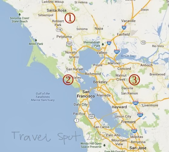
You may remember I have mentioned the Dipsea before. It claims to be the oldest trail race and has been going on for over 100 years. It goes from Mill Valley, up and over a hill and then back down to Stinson Beach.
The quad Dipsea is up and over to Stinson, and then back to Mill Valley and then back to Stinson again and then back to Mill Valley. The first section from Mill Valley, for about a mile and a gain of around 500 feet, is all stairs. After that, it's back down hill and then you begin the climb to Cardiac.

It was about 40 degrees when we started. I opted to go with tank top and shorts because I had made the overdressed mistake in the past. I ran this as one of my team races, with an ultra team that I joined a few months back. The other members are a lot of fun and are very encouraging. We don't run together, but it's still fun to have more people to cheer on along the way.

The first climb was not bad. I had a lot of energy. I was passing people, as I often do on the uphills. I got to the top of Cardiac and skipped the first aid station. I headed back down the other side to Stinson and was still feeling great. This race was fun for the fact that once I got about half way down, the leaders of the pack started to come back up. There were so many "great jobs" and "way to gos" being thrown out and you saw so many people that you knew, whether they were in front of you or behind you. It was very encouraging, especially since trail races usually are not very well spectated, due to their difficulty to reach for most people.
I got down to Stinson Beach and fueled up with some cantaloupe and headed back up the hill to Cardiac. This section is partly trail, partly stairs and it pretty steep the entire way. This section was mostly speed hiking/jog/walking. There was barely any time when it wasn't either uphill or downhill. Usually there is some flat, but this time, there was very little. Finally, it was back to Cardiac again and then back down the big hill, back up the little hill and then DOWN the stairs, which was way harder than up, since they are all different lengths and heights. It is hard to get a rhythm, plus there are other regular Saturday walkers out and about with their dogs and kids and families.
I arrived back at Mill Valley and my family was there, cheering me on. My Mom snapped this photo; it makes me look really fast.

After another handful of canteloupe and a piece of pumpkin pie (I love ultra food!) I headed BACK up the stairs. This was not too bad either. Of course, this time, I was not moving as fast as I had the first time! But I was still feeling good. At Cardiac I ran into a friend who was taking photos, gave him a high five and headed back down the hill again. Before I reached Cardiac, the front runner passed me heading the other way. The next person behind him was at Cardiac at the same time as me, making him about 20 minutes behind the leader. It was pretty impressive. He was just blowing down the hills like a maniac!
On the way down to Stinson, I still felt good. I saw a ton of people I knew and the "good jobs" were still flowing! I got to the beach, ate, and headed back to Cardiac. This is where is got a little difficult. After Cardiac, the long downhill was a bit muddy and rocky, with roots and rocks and bumps in the ground. My knees were starting to get a little tired, but it didn't seem like a big deal. Then one of them really started to bug me, so instead of overdoing it, I slowed to a walk for a while. I got passed by a bunch of people, including 2 girls (darn it!) at this point.
When I got to the stairs, I took it easy, and got back to the end a little after I wanted. I had set a goal of 5:45, but I came in at 5:52. I was still happy to be under 6 hours though!

Total elevation gain: 9200 feet
The winner set a new course record of 3:48. You can read more about it here. The second place runner got 4:15. The first girl got 5:06. I call that impressive! I was the number 10 female out of 72, and the 59th out of 249 overall.
I don't know if I burned off my two turkey dinners, but I sure had fun trying! (PS I went to the gym on Monday and there were at least 2x more people than normal. I am not the only one trying to burn off that turkey!)
How did you burn off your turkey dinner? What did you do for Thanksgiving? Do you participate in a turkey trot or any Thanksgiving day exercise?
I hope everyone had a really great Thanksgiving! I did. I double booked myself and had BBQed turkey and 3 different kinds of pie at my brother's house and then had second turkey dinner with homemade candy at my aunt's house. The best part was my parents made it to both, which I missed last year (they went back East last year). So it was good times, good food, good friends, good family! And I took home the carcass and made some super good stock.
So...how to burn off these two dinners (and massive quantities of dessert)? Hill work, of course.
You may remember I have mentioned the Dipsea before. It claims to be the oldest trail race and has been going on for over 100 years. It goes from Mill Valley, up and over a hill and then back down to Stinson Beach.
The quad Dipsea is up and over to Stinson, and then back to Mill Valley and then back to Stinson again and then back to Mill Valley. The first section from Mill Valley, for about a mile and a gain of around 500 feet, is all stairs. After that, it's back down hill and then you begin the climb to Cardiac.
It was about 40 degrees when we started. I opted to go with tank top and shorts because I had made the overdressed mistake in the past. I ran this as one of my team races, with an ultra team that I joined a few months back. The other members are a lot of fun and are very encouraging. We don't run together, but it's still fun to have more people to cheer on along the way.
The first climb was not bad. I had a lot of energy. I was passing people, as I often do on the uphills. I got to the top of Cardiac and skipped the first aid station. I headed back down the other side to Stinson and was still feeling great. This race was fun for the fact that once I got about half way down, the leaders of the pack started to come back up. There were so many "great jobs" and "way to gos" being thrown out and you saw so many people that you knew, whether they were in front of you or behind you. It was very encouraging, especially since trail races usually are not very well spectated, due to their difficulty to reach for most people.
I got down to Stinson Beach and fueled up with some cantaloupe and headed back up the hill to Cardiac. This section is partly trail, partly stairs and it pretty steep the entire way. This section was mostly speed hiking/jog/walking. There was barely any time when it wasn't either uphill or downhill. Usually there is some flat, but this time, there was very little. Finally, it was back to Cardiac again and then back down the big hill, back up the little hill and then DOWN the stairs, which was way harder than up, since they are all different lengths and heights. It is hard to get a rhythm, plus there are other regular Saturday walkers out and about with their dogs and kids and families.
I arrived back at Mill Valley and my family was there, cheering me on. My Mom snapped this photo; it makes me look really fast.
After another handful of canteloupe and a piece of pumpkin pie (I love ultra food!) I headed BACK up the stairs. This was not too bad either. Of course, this time, I was not moving as fast as I had the first time! But I was still feeling good. At Cardiac I ran into a friend who was taking photos, gave him a high five and headed back down the hill again. Before I reached Cardiac, the front runner passed me heading the other way. The next person behind him was at Cardiac at the same time as me, making him about 20 minutes behind the leader. It was pretty impressive. He was just blowing down the hills like a maniac!
On the way down to Stinson, I still felt good. I saw a ton of people I knew and the "good jobs" were still flowing! I got to the beach, ate, and headed back to Cardiac. This is where is got a little difficult. After Cardiac, the long downhill was a bit muddy and rocky, with roots and rocks and bumps in the ground. My knees were starting to get a little tired, but it didn't seem like a big deal. Then one of them really started to bug me, so instead of overdoing it, I slowed to a walk for a while. I got passed by a bunch of people, including 2 girls (darn it!) at this point.
When I got to the stairs, I took it easy, and got back to the end a little after I wanted. I had set a goal of 5:45, but I came in at 5:52. I was still happy to be under 6 hours though!
Total elevation gain: 9200 feet
The winner set a new course record of 3:48. You can read more about it here. The second place runner got 4:15. The first girl got 5:06. I call that impressive! I was the number 10 female out of 72, and the 59th out of 249 overall.
I don't know if I burned off my two turkey dinners, but I sure had fun trying! (PS I went to the gym on Monday and there were at least 2x more people than normal. I am not the only one trying to burn off that turkey!)
How did you burn off your turkey dinner? What did you do for Thanksgiving? Do you participate in a turkey trot or any Thanksgiving day exercise?